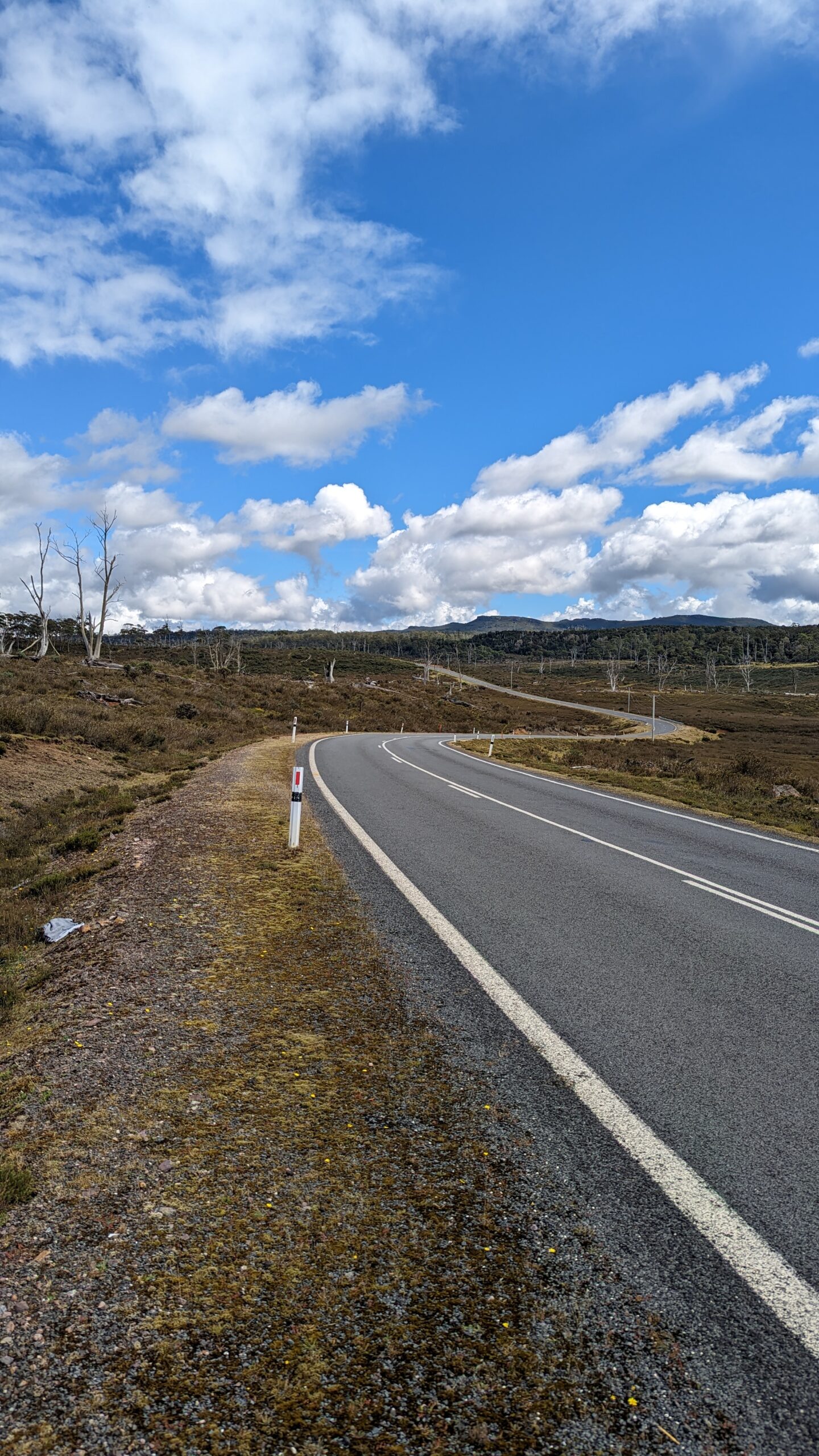
Western lutruwita Bikepacking Trail
Words & photos by Adam Gillespie
Route on ridewithGPS
11 minutes
After quitting my job and hearing about the beauty and ruggedness of the Tasmanian Trail I decided to come to Australia on a working holiday visa and travel by bike.
I flew straight to Hobart from my home in Minnesota, USA and I spent a few days in Hobart reassembling my bike, doing research on the route, and gathering gear. Before I even left to start the Tasmanian Trail, I decided I wanted to see more of lutruwita than just what’s along the trail. I searched for other bikepacking routes on the island but didn’t find much that linked the whole island together besides Emma Fluke’s The Tassie Gift route which seemed too hardcore for touring, and some road touring routes that were too soft for my taste and mostly on bitumen.
I came to the idea (after being inspired by Emma’s build your own route mentality) that I wanted to create my own bikepacking routes that complimented the Tasmanian Trail and linked “all” of lutruwita. I’d never planned out anything more than an overnighter, but had been wanting to get some experience with long distance route building. My goal was to build a route that was a similar difficulty to the Tasmanian Trail (challenging in sections, but relaxed in others) and brings you to many of the beautiful “must see” places throughout the island. I also wanted the route to be publicly accessible so that other folks like me that want to bikepack all around lutruwita would have a so-called template to use and either follow my route or create their own adventure from what I did without having to do all the heavy lifting of starting from scratch.
I decided it was good practice for my route building skills as well as convenient for others to include plenty of POIs, so you’re not left wondering where to camp, eat, get water, find groceries, and what landmarks are nearby, etc. I chose to build a route specifically for the west, and one specifically for the east (coming out soon). That way people could do them separately on shorter trips or piece both together with the Tasmanian Trail to do a full figure eight of the island.
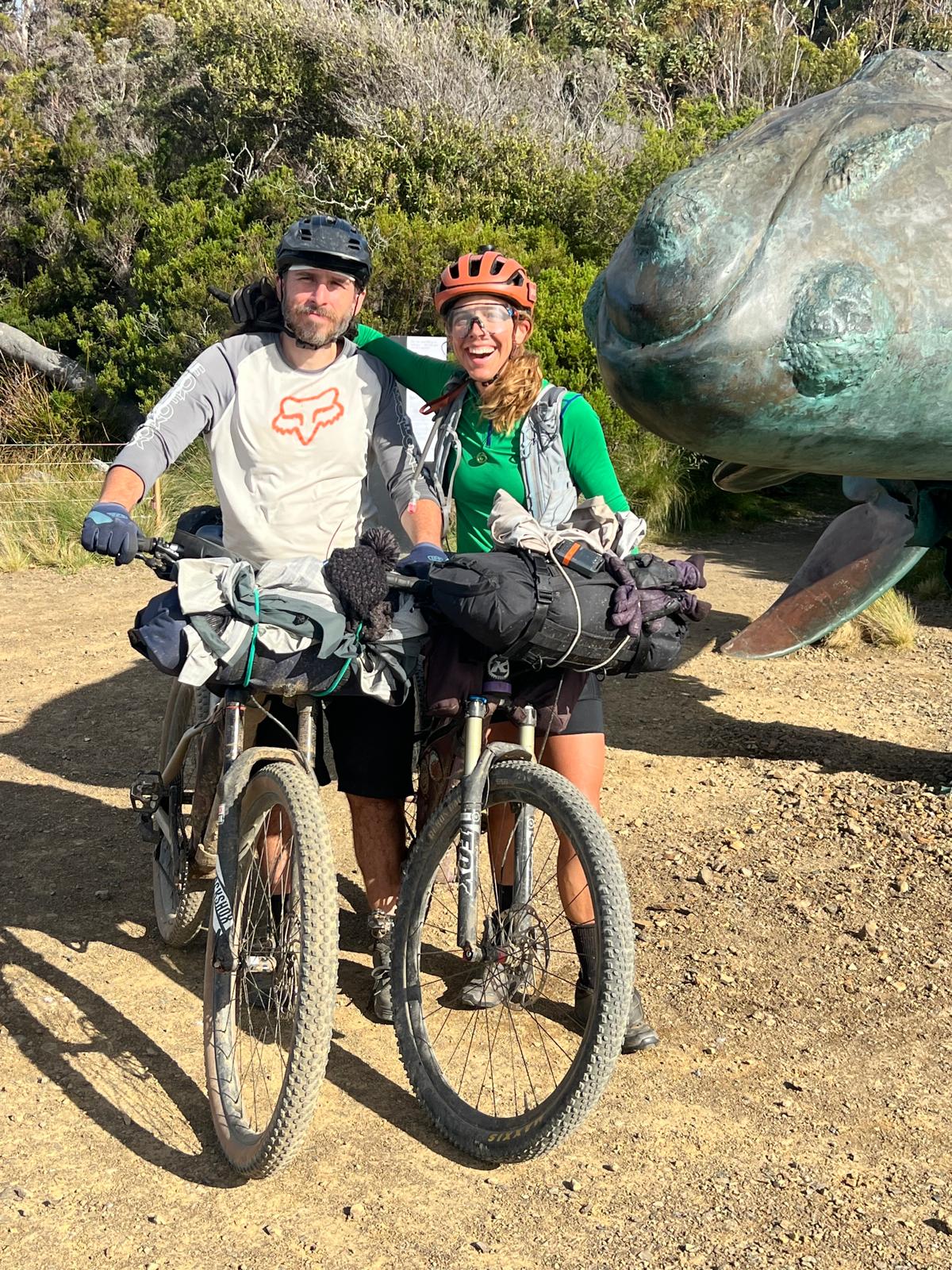
One of the themes of this route is visiting some major mountain peaks in lutruwita. On my first night on the Tasmanian Trail, after riding to Cockle Creek, I camped at the Esperance River Campground where I met an inspiring woman attempting to summit all the Abels in Tasmania (peaks above 1100m). As I dried out my soaking wet gear from the rain encountered over the last 12 hours, we chatted over dinner and ended up getting along quite well. We found that we had a similar timeline for the next week or so, and made plans to meet back up at Mt Field for some day hikes and then again later at Lake St Clair for a 4 night backpacking trip to tick off some of her Abels.
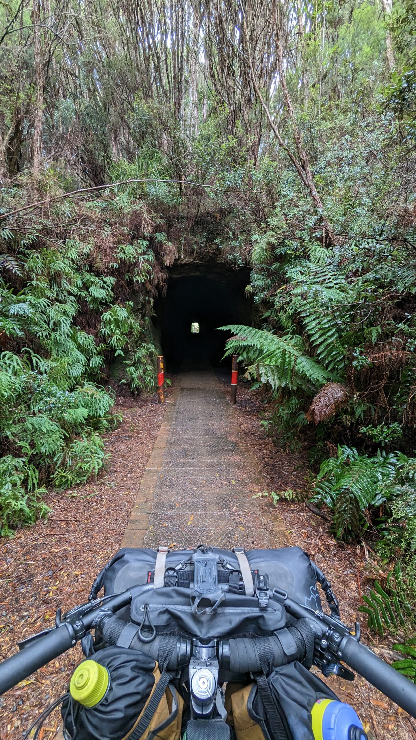
Luckily I had good clipless shoes with vibram soles that worked well for hiking when I took out the metal cleats, and she had some spare gear to make the backpacking possible as well. I had such an incredible experience during both of those trips that I decided to incorporate some of the iconic peaks into my routes while I traveled around lutruwita. Hiking Mount Roland, Cradle Mountain, Mount Murchison, and Mount Owen were definitely some big highlights of this route for me. It was a nice way to spend some time out of the saddle and build strength and stretch your legs in a different way than you get to on a bike. Plus you got wild panoramic views that simply weren’t possible to get from a bike.
I highly recommend taking this route slowly if you can, and planning half to full days to see some of the mountains as well as the other attractions I’ve included. I spent two two and a half months total in lutruwita and it was not even close to as much time as I’d like. If you don’t have gear or the ability to do the hikes, the good news is that you’ll still get lovely views of the mountains along the route regardless.
Highlights of the Route
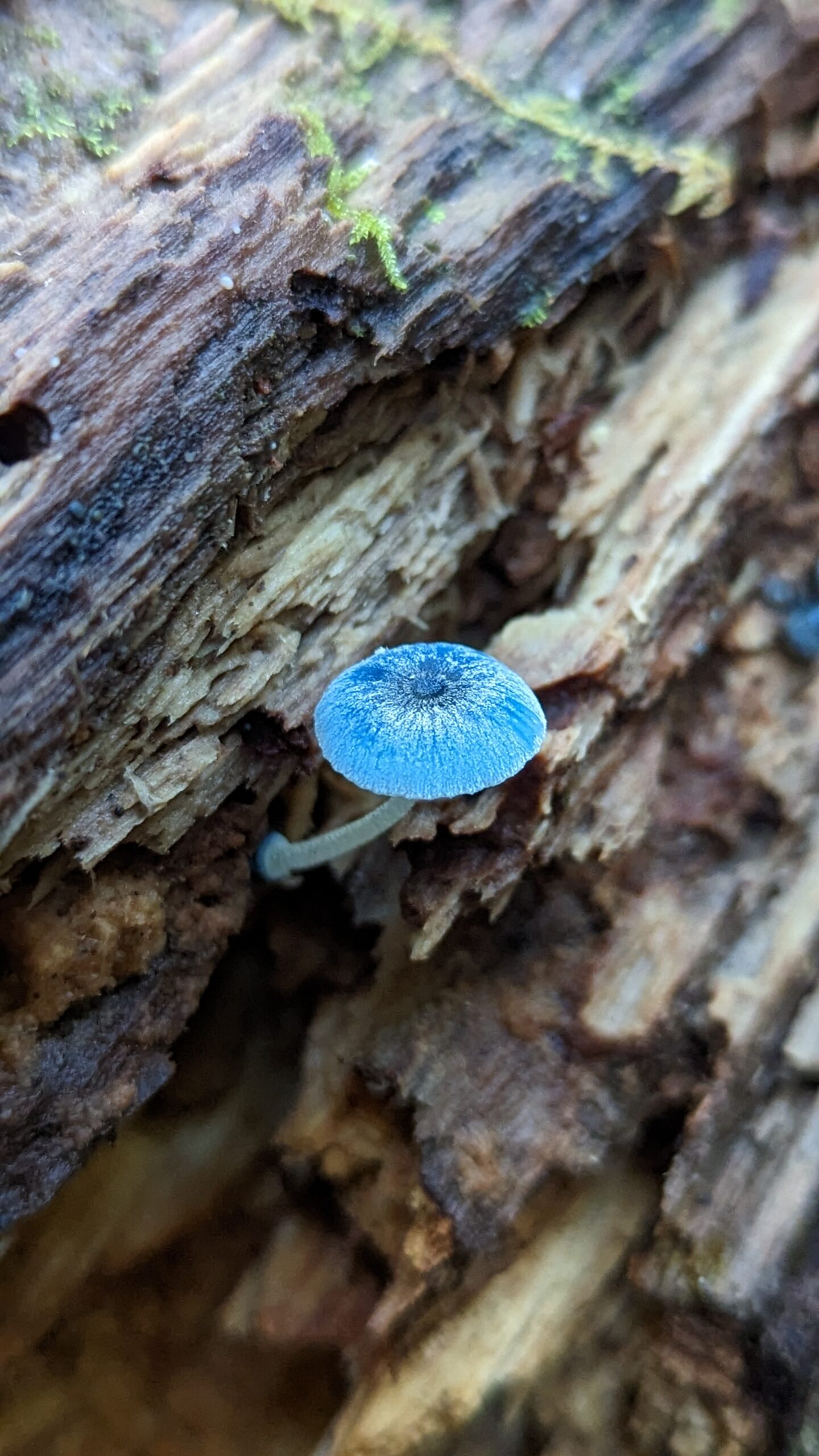
As a mycophile (mushroom lover), I’m inherently enamoured with temperate rainforests for their abundance of fungi. I was very excited to spend time in the takayna/Tarkine region hiking to waterfalls and visiting forested walking tracks. Some of the waterfalls like Montezuma Falls and Nelson Falls were breathtaking. Specifically the day spent riding to Montezuma falls was probably the best time I had on this route. Although it was pouring rain and I was soaking wet, looking for fungi, clearing fallen logs from the track, and taking it slow was pure bliss and of course the falls were spectacular.
One unexpected highlight was spending some time in a backpackers room in Queenstown to avoid thunderstorms and hail in my little one-person tent. While I was there carb loading at the Empire Hotel I ran into a couple of van dwellers that recognized me from when they passed me North of Corinna. They told me about the Franklin film at The Paragon Theatre, a beautiful restored theatre in town. It was quite inspiring and made me emotional when reminded that just like the person in the film, I was inspired by my father to spend a good part of my free time going on adventures outdoors. I wouldn’t be touring by bicycle if it wasn’t for his influence. I knew of the Franklin River before watching that film, but learning it’s true significance made it quite special to go to the Franklin River Walking Trail along the route.
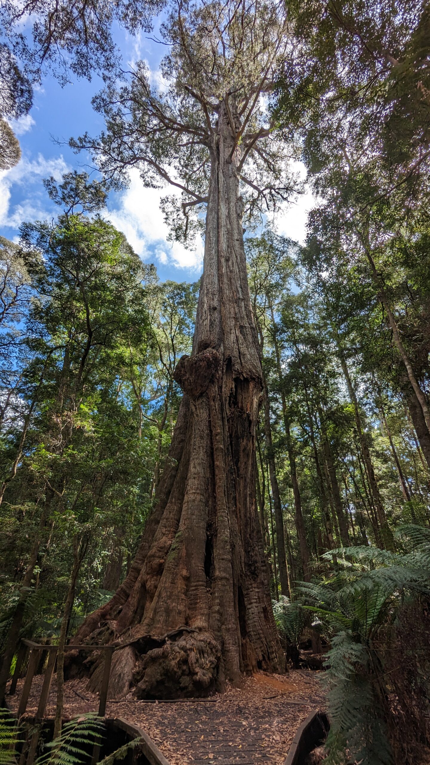
Like most bikepacking routes, you end up cycling through a lot of logging areas and it’s tough to see forests being constantly cut down and thinned instead of being untouched and wild. However one of the best things about cycling in western lutruwita is the massive amount of gorgeous giant trees speckled throughout the forests whether wild or not. I learned about the giant Eucalyptus trees in the Styx Valley from a Warmshowers host in Maydena. He told me it’d be mad to cycle through the region and not see the trees and showed me posters of some of famous giants with arborists on them to give scale. They are some of the biggest trees in Australia, absolutely stunning. It’s well worth the short hikes off the bike to see these beautiful old growth trees.
Challenges on the Route
It seems like most people bikepacking and especially solo bikepacking find the mental challenge to be much harder than the physical challenge. I consider myself to have a really good mental capacity for solo bikepacking, but I had a wake up call early on in this trip. I got in my head about riding my first planned route with limited knowledge of the area and doing little research, having infrequent resupply points, and almost guaranteed cool, wet weather.
I ignored the anxious feeling caused by all those factors, and I rode 135km in one day from Cradle Mountain to Boat Harbour. During the day I had an abnormally high heart rate the whole time, knowing I had to push it physically, I’d be cutting it close to sunset, and I also did not knowing exactly where I’d stay. I could literally feel the anxiety in my body and I just ignored it which was easy since I was just pushing it and cycling hard all day. When I finally got coverage, I called the caravan park at Boat Harbour and luckily got a spot. At the end of my day after telling the caravan park host how far I’d come, his wife offered me salmon quiche and a salad. When he walked away and I started eating, I broke into tears. I had no idea how much I needed a small act of kindness like that. It made my day. I was so happy to be eating a warm fresh meal and to have a beautiful, cushy place to camp for the night with showers and a kettle (such a treat). I journaled that next morning on the beach about the experience, and learned so much about my mental health in situations like that. I learned that if I am experiencing any sort of negative emotions or are anxious about something, I need to address them rationally immediately rather than just biking and ignoring my feelings. More than once after that instance on this trip I experienced that type of anxiety and have been able to work through them much more efficiently. My mental fortitude is heaps stronger after this trip.
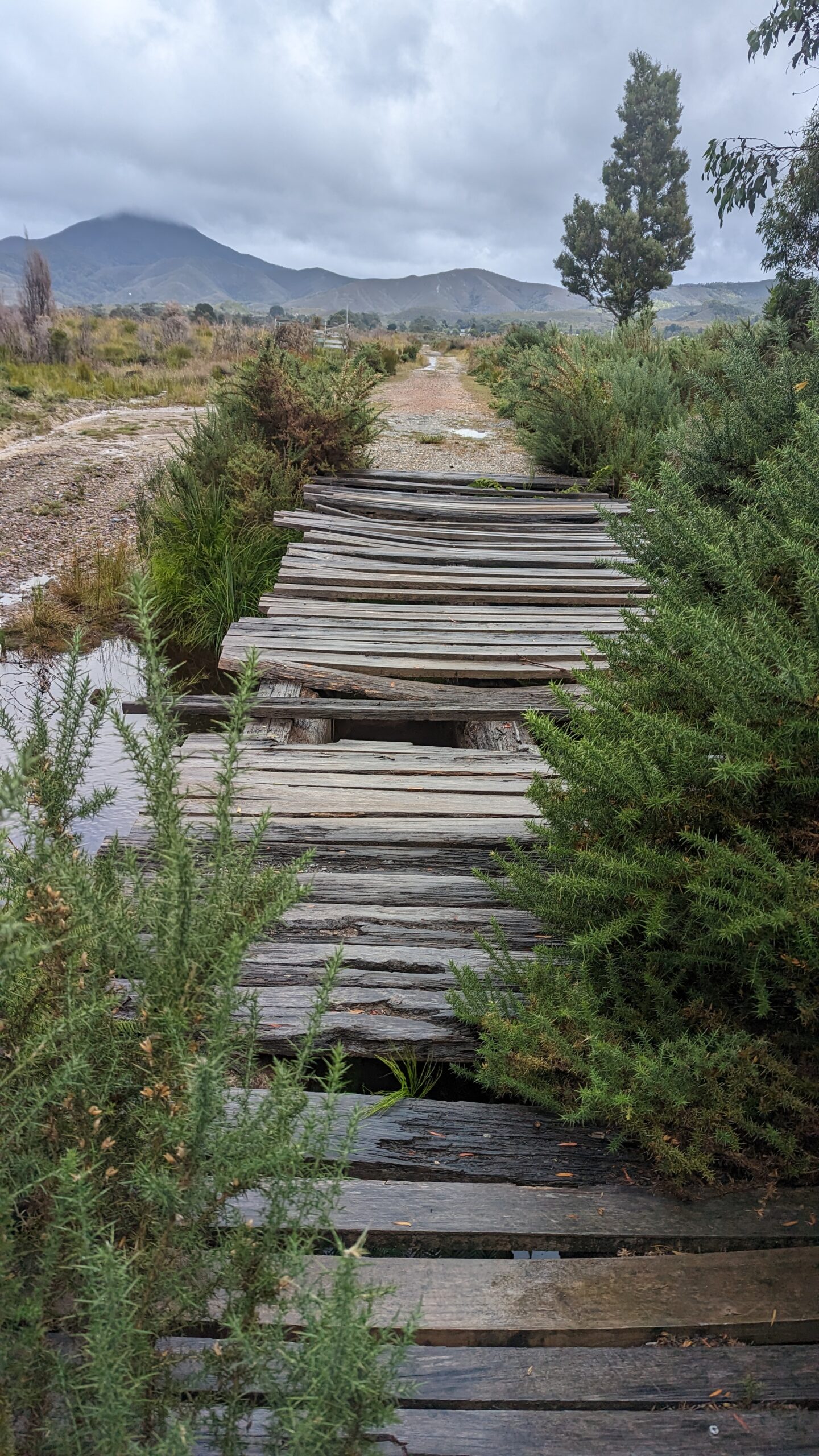
Another one of the challenges faced while building this route was finding closed roads. On the way to Arthur River from the Trowutta Arch, I rode through a relaxing road deep into a logging area. Once I got to one of the few intersections, I saw a no thru road sign in the direction I was headed. This meant a roughly 20km detour and it was already late in the afternoon. Luckily a quarry truck driver was passing by. I waved him down and he told me that the road used to go through to Arthur River but the road closed a long time ago and was pretty overgrown. I told him as long as it’s not flooded or private land, that sounds like it’s doable by bike. So I went for it. It was gorgeous biking on an overgrown road, totally worth hopping over the fallen logs and walking around giant holes in the road. However right before linking up to the road to Arthur River, the road came to a closed gate. The gate was unlocked but also had a single electric fence wire close behind it. At that point I was past the point of no return, so I slowly slid under the wire and rode through the paddock on a thin remnant of a road and passed under one more wire and one more unlocked gate. I’m not a proponent of going through private land with no permission so my heart was racing most of the time, but I made it to Arthur River that night just in time to see the sunset over the ocean. Although the westerly winds were blowing sand from the beach into my ramen, I was relieved to make it through the day safe and sound.
As I mentioned earlier, I went to Queenstown to avoid thunderstorms and hail. When I woke up near Corinna it started raining and after taking the ferry across the Pieman River, I rode to Zeehan. That was the first place I had reception in a while and check the weather to find the severe storms approaching. After calling 7 other places for indoor accommodation, I finally found a room in Queenstown so I booked it all the way there on main roads. It completely messed up my route plan which was stressful knowing I either had to skip a lot of stuff I wanted to see or ride back into headwinds and wait for good weather. In the end the headwinds weren’t too bad, the weather got better, and I found some sections I didn’t intend on doing that were too beautiful not to include in the final route.
Tips for the Route
Be ready for any type of weather. lutruwita’s weather can change very quickly. Bring rain pants, booties, and waterproof gloves. On some of the cold wet days rain gear is what keeps you warm even if it’s not always raining. Depending on what time of year you go, also be prepared for freezing temperatures – have a warm sleeping bag and warm clothes for camp.
Bring plenty of food, you will work hard and your body deserves to be well fueled for working so hard to get over those Tassie mountain passes. I underestimated how much I needed to consume and by the time I got to Maydena I ended up losing a good 3kg.
Always have a backup campground. Some campsites can be flooded, unexpectedly closed, and some campgrounds can book up quickly. Wikicamps is a priceless resource not only for camping but for toilets, water, and things to see. Unfortunately there are next to no warmshowers hosts along the route, so definitely don’t bank on that either.
Be dynamic. This route is meant to be a template where you can create your own alternates on easier (or harder) roads if you want, jump off the route to some extra attractions, and make your days whatever distance works for you. No matter where you go, there is beauty on every road in Tassie. If you don’t have mountain bike tires, you may want to skip some of the singletrack and 4×4 sections. Look ahead and see what lies ahead for the next day and use your best judgement.
The Route: https://ridewithgps.com/routes/42064471