Brisbane to Tenterfield Loop
Words & Photos by Annette Dexter
11 minutes
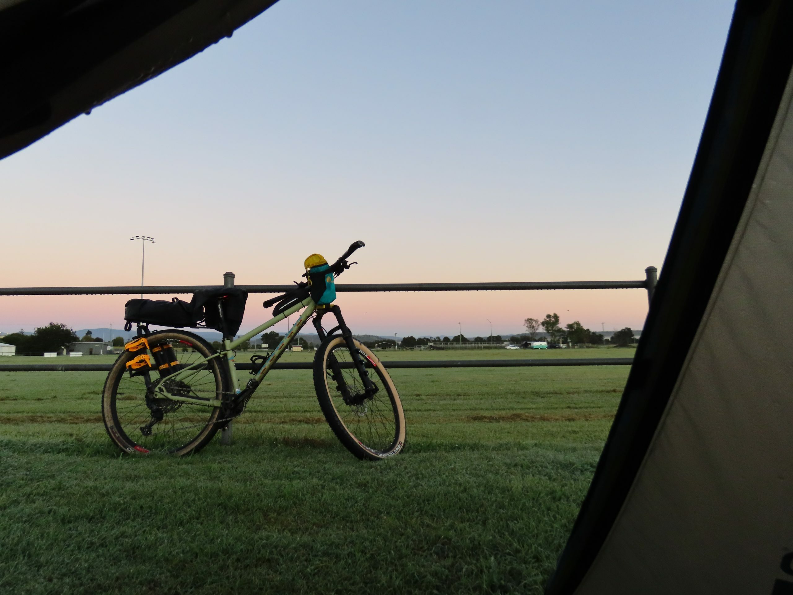
Day 1: Brisbane to Laidley
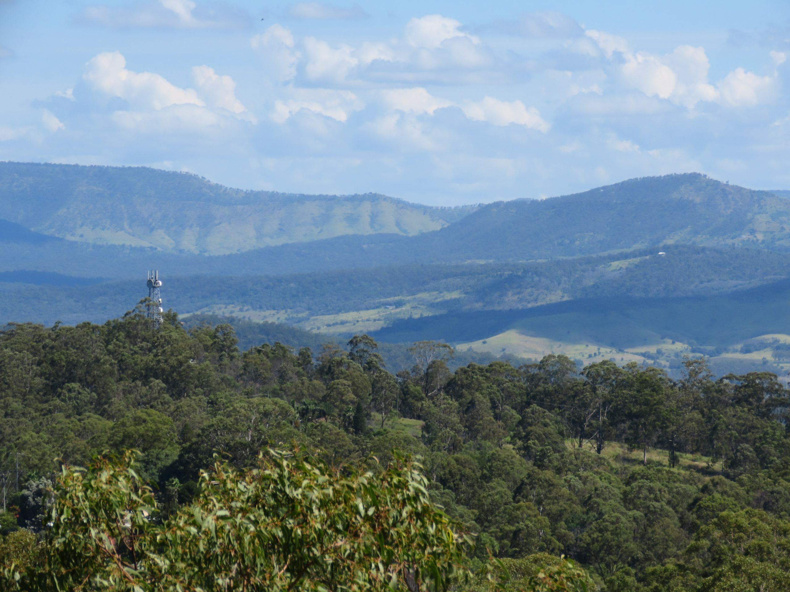
I left from home just before 6.00am for my biggest trip yet, eight nights away. After my standard route to Ipswich, used many times to get to the Brisbane Valley Rail Trail, I followed beside the rail line from Wulkuraka to Rosewood then on to Grandchester.
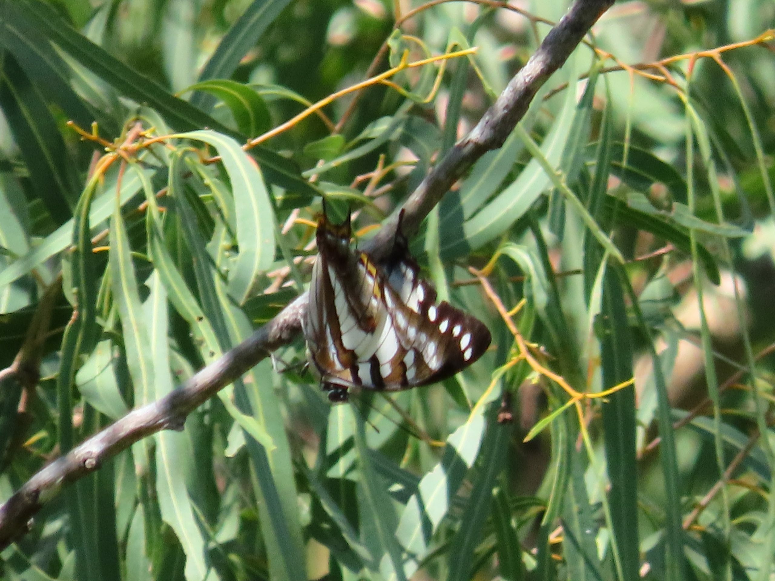
My planned dirt cut-through to Cunningham’s Crest Lookout turned out not to exist, so I detoured 20km toward Hatton Vale then headed back up. I was thrilled to find it was a hill-topping site for Tailed Emperor butterflies, with three males dogfighting for access to females. I managed a long zoom shot, then headed down to Laidley Showgrounds.
I woke in the night to a sprinkle of rain. There had been nothing in the forecast, so I checked the radar. A massive rain band was slipping by to the south: Warwick had already had more than 50mm. Lucky I hadn’t taken my original route via Spicer’s Gap: the western cobblestone descent is treacherous when wet.
Day 2: Laidley to Warwick
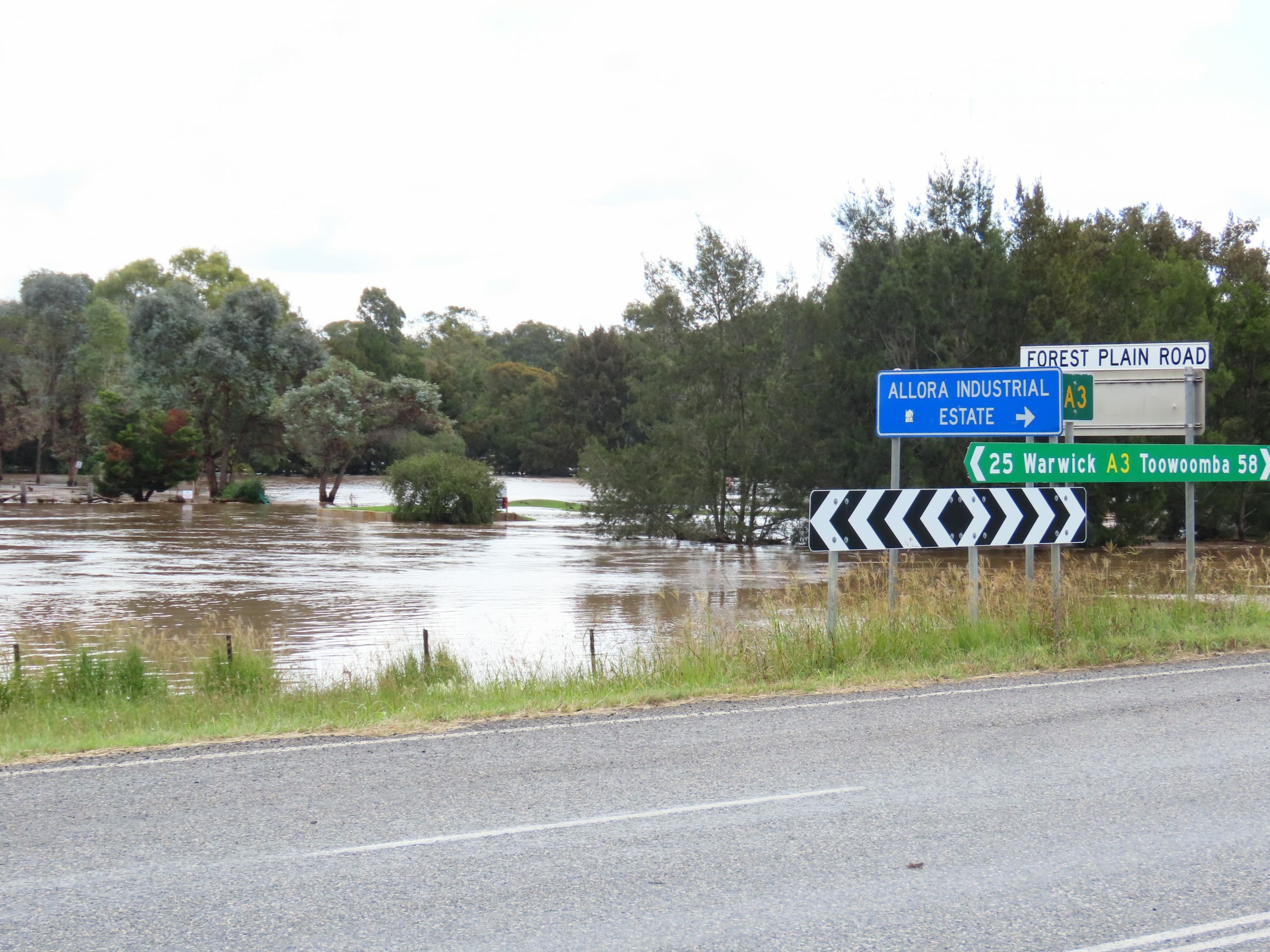
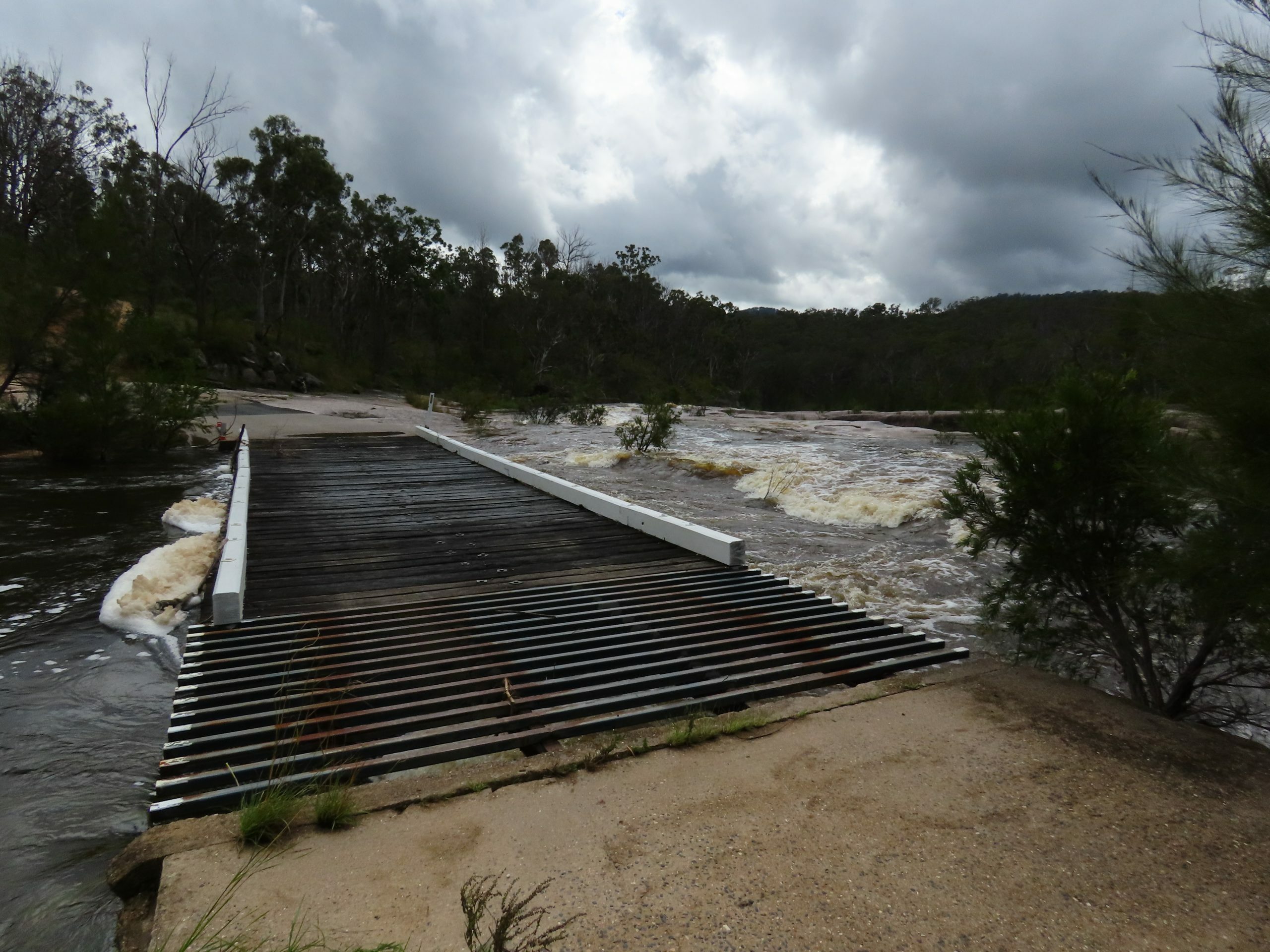
I had 120km to ride, so packed a damp tent and left by 7.00am. After back roads to Ma Ma Creek, I headed up Gatton-Clifton Road. Heifer Creek was running fast and dirty. Coming down off the Great Dividing Range, I started to see standing water and was forced off side roads back onto the New England Highway. I reached Allora at one o’clock. It was heavily flooded, and the road to Warwick was cut at Glengallan. “Bridge should be open by the time you get there though,” Highway Patrol told me.
I rode out of Allora and past a long line of stopped traffic, reaching the bridge after 10km. It was clear of the water, but still closed. No, I couldn’t walk my bike across the bridge: they needed to assess the structural integrity first. I retreated to the line of traffic and spread out my solar panel, hoping to get some charge in the power bank. Some of the motorcyclists had been waiting over seven hours, and the truckies were losing patience too. There was a rumour the bridge at Warwick would be shut by a rising Condamine River by the time this one opened. We watched while a grader and a water tanker cleaned the bridge, after which engineers arrived to assess, poking sticks into the water. Time was running out. If the bridge didn’t open by 4.00pm, I would back-track to Allora, but that would mean an extra 25km on the New England Highway the next day.
At 3.54pm, the bridge finally opened. I let traffic pass for 15 minutes then joined the tail of the line into Warwick. Leslie Dam campground was unreachable, so I stocked up at the IGA and paid school holiday rates at a caravan park in town.
Day 3: Warwick to Storm King Dam
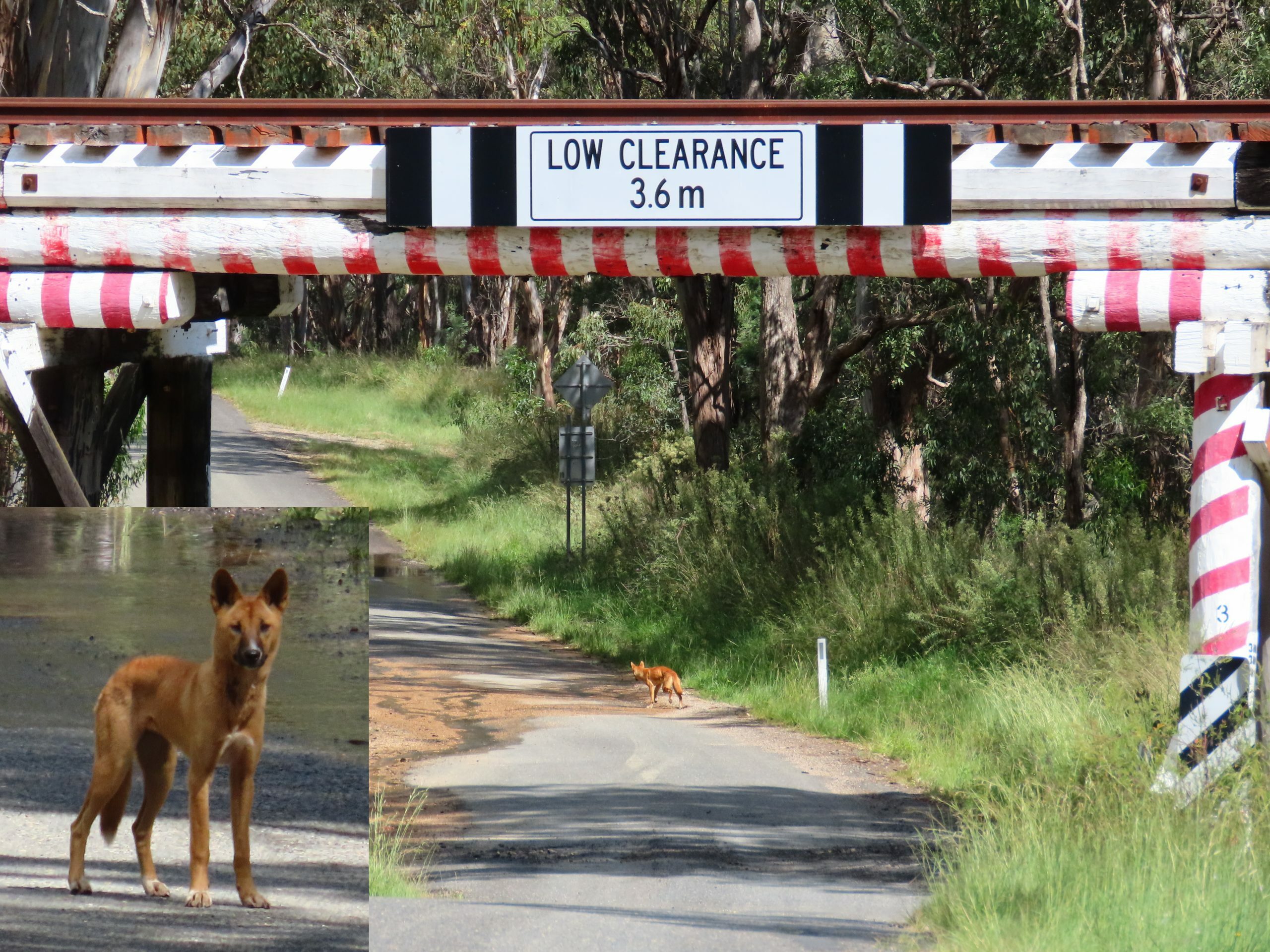
The QLDTraffic app still showed Old Stanthorpe Road cut the next morning, but without recent updates. I decided to risk water crossings rather than the highway. The floodways turned out to be manageable, the water only 5-10 cm deep even when fast-flowing. At Cherry Gully, a wild dog, perhaps half dingo, trotted out of the bush to observe me.
A call at Stanthorpe confirmed the campground at Storm King Dam was still open. I got there in good light and set up on drying grass. Neighbouring campers wandered past with champagne flutes and invited me over for an evening of conversation. Was I due to be picked up by car, they wondered?
Day 4: Storm King Dam to Cypress Pine
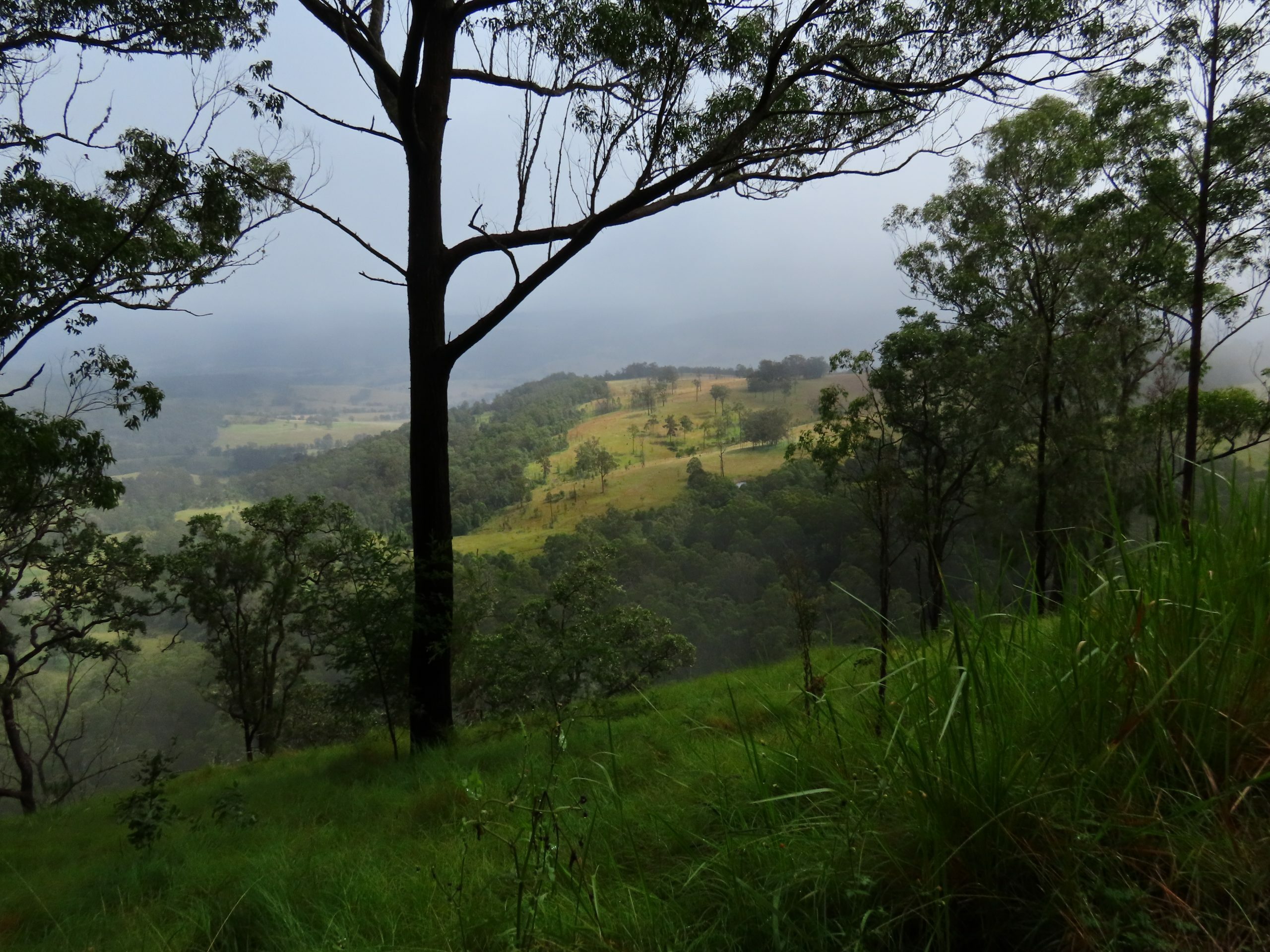
Today’s route had me concerned. A 500m altitude drop on Harrigan’s Lane led to the Boonoo Boonoo River and the state of the crossing was unknown. I had planned to retreat and enter the National Park from Mount Lindesay Road if the river was flooded, but as I descended on steep bitumen sections, it became clear I wouldn’t be able to ride back up.
When I got to the river, the bridge was clear of the fast-moving water, but only just. On the far side, I was stopped by a farmer in a 4WD. “Are you okay?” he asked. “Are you lost?” I told him this was my planned route into the National Park. He looked doubtful. “I think there’s a locked gate,” he said. “I guess you can just flip the bike over though?”
The next 24km on Gilgurry Lane was slow going on deeply rutted farm double track. At the top of a hill, I came across a snake-necked turtle. It retreated rapidly into its shell and peered at me with one eye. Are you okay? I wondered. Are you lost? Am I going THAT slow?
At 1.00pm I reached the turn-off to Lindrook Road and what I hoped was the back route to Boonoo Boonoo National Park. Perhaps the locked gate was here? Worse. The grid entry was marked Construction, Authorized Personnel Only, No Access to Mt Lindesay Rd. I had no good options. Either 17 km to the campsite with a steep climb and a risk of being turned back, an unworkable 70-80km via Tenterfield, or camp beside the road with no water.
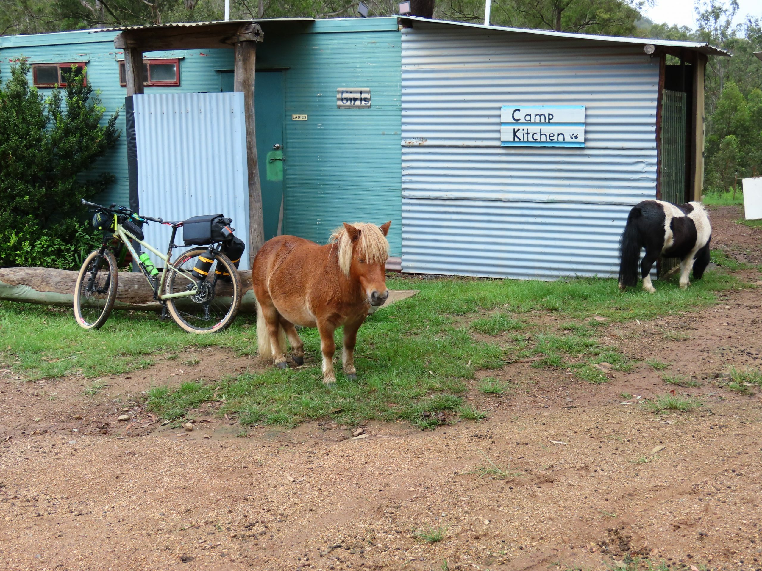
I headed in, looking out for signs of recent vehicle movement. After a few minutes I came to a clearing with a dirt pile and a fair-sized sapling growing out the top. A little past this, a sign read, State Forest Open, Drive with Care. Relief. The climb got rougher, but it was passable, and two gates turned out to be unlocked. Only the Casuarina Trail ended up needing any hike-a-bike. I got to Cypress Pine at 4.00pm and set up in light rain. Another camper offered me drinking water, which I accepted rather than filtering from the tank.
Day 5: Cypress Pine to Rover Park
Out of food, I detoured into Tenterfield via Mount Lindesay Road. There were missed calls from my next destination, Rover Park. I called back and, on a shaky connection, confirmed that I was still staying (No, not a caravan, a pushbike) and estimated my arrival at 3.00pm.
I turned off the Bruxner Highway toward Rover Park mid-afternoon. On the 5km driveway, a dirt climb turned into a killer bitumen pinch, then an even steeper bitumen dipper and a dirt descent. At the house, a sign read, If The Gate Is Open, Head To The Kiosk. A rough dirt descent later, I found a toilet block, a ramshackle shed and wandering livestock, but no owner and no obvious place to set up a tent. Now what? I rode-walked back up, but there was still no-one around and it was getting late. I headed down and set up my tent and bike in the shed-kiosk, away from an increasingly pushy horse, and took a cold shower. The water ran brown as I rinsed out my gear. I only had half a bottle of water left over from Cypress Pine. I filtered some tap water through my Sawyer Squeeze: the back-wash was rust-red.
Just on nightfall, the owner turned up. In fact the park was temporarily closed: his wife was in hospital after a fall from a horse, but as I had pre-registered I was fine to stay in the shed. No, the water was just from the farm dam. If I needed anything that night, I should feel free to pop up the hill.
I slept badly. Rain kept sweeping over and the shed was leaking. The next day’s dirt sections could be in poor shape. I decided I would have to take bitumen along the Bruxner to Tabulam, possibly 25km further to Urbenville. It could be a long day.
Day 6: Rover Park to Urbenville
I started early, in poor light and a worse mood. At the house, I filled my bottles with clean water, paid the owner and rode-walked the driveway out. At the Bruxner, I pumped the tyres to 40 psi and set out to make up time. Tabulam was not indicated on road signs, but came up quicker than expected, so I stopped for some real food and to charge the power bank. Now that I had signal, Ride With GPS showed this way would only be an extra 10km.
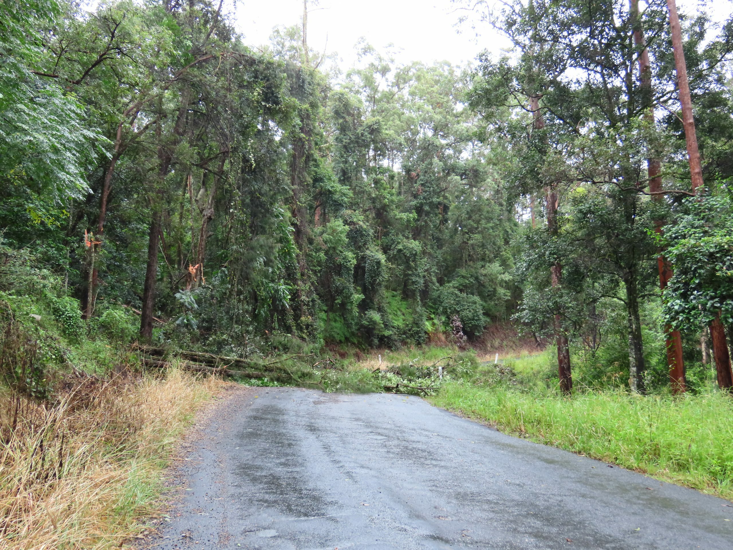
It rained intermittently up Clarence Way and I had the rain cover on and off the phone, as it was hard to operate the covered touch screen. The last climb through Yabbra was less steep than it had looked on the profile. A welcome tree down over the road meant no more following traffic and the sun broke through over Crown Mountain as I crested the last hill to Urbenville.
I had planned to stay at the showgrounds, but they were completely unusable in the mud. In a stroke of luck, the Crown Hotel was celebrating its opening night under new owners. Setting up my tent in a back corridor, I was the official first guest.
After a pub dinner, drinks and chats with the locals, I got a rude shock. My iPhone charge port had gotten wet, and it was no longer possible to charge it. I scribbled route notes with the last remaining battery charge: I would be finding my way home without a GPS.
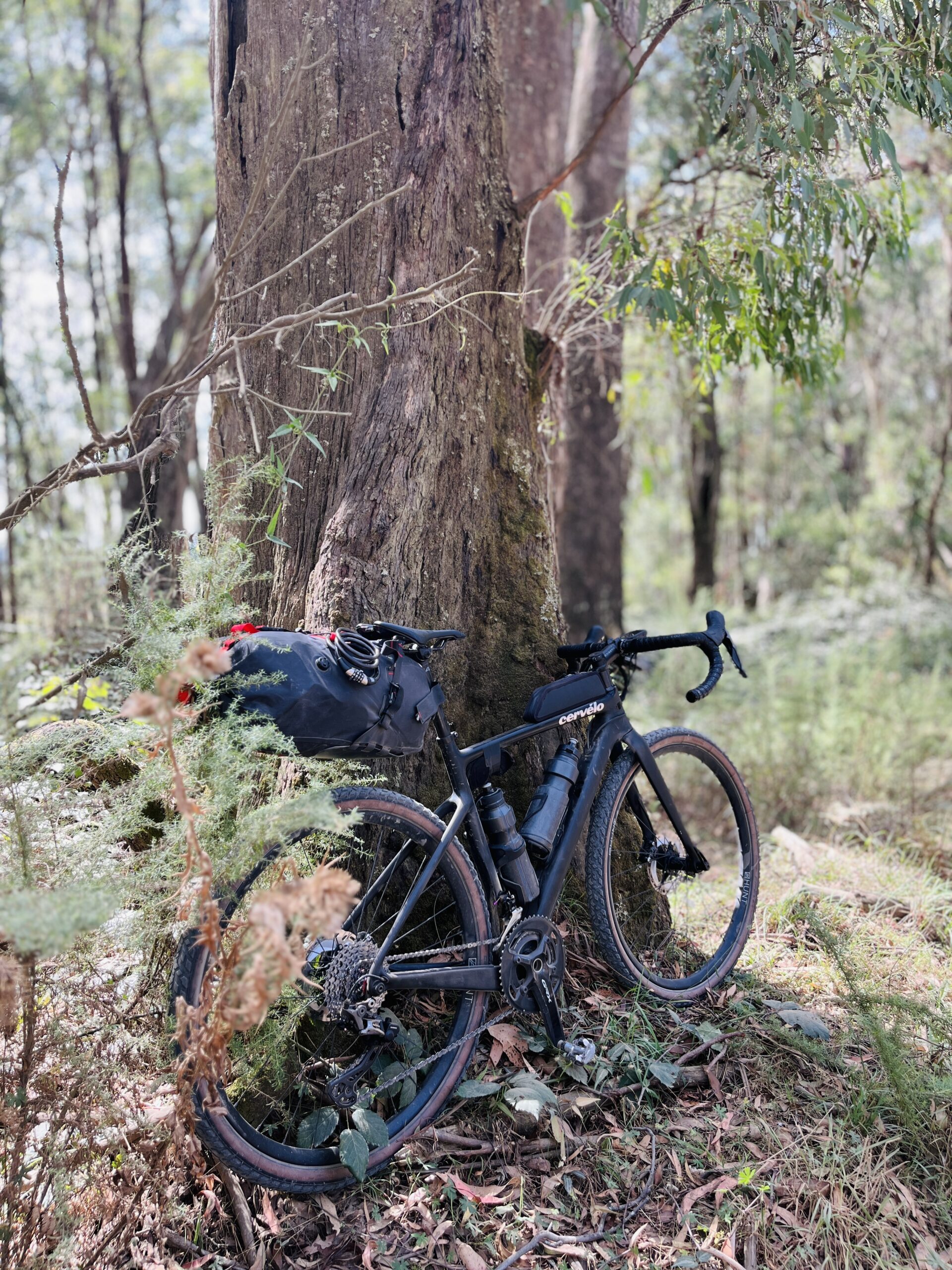
Day 7: Urbenville to Queen Mary Falls
Today’s route, via Tooloom and Legume, I knew by heart. I had ridden it in each direction before and the distance was short (around 50km), though there were three decent climbs.
I left late after generously being fed breakfast by my Crown Hotel hosts, and pedalled soft. I got to Queen Mary Falls Caravan Park mid-afternoon and bought a sandwich, two muffins, a bag of bird seed and a coffee. The unpowered sites were too wet to use, and the owner walked my purchases up the hill to a powered site. I set up, ate the sandwich and fell asleep for a solid twelve hours.
Day 8: Queen Mary Falls to Kalbar
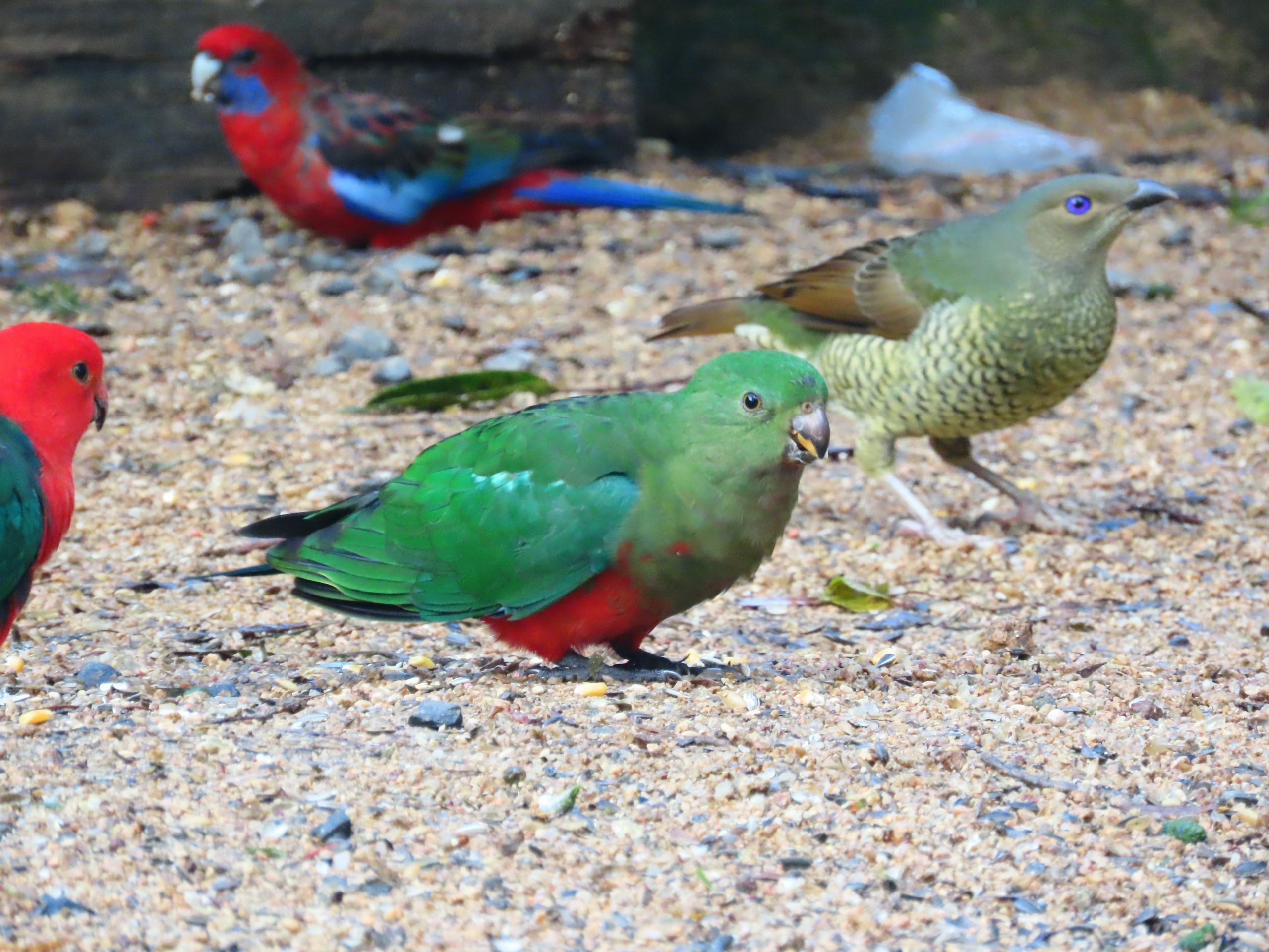
I woke before dawn and made good use of the bird seed. Food scattered in front of the cafe quickly attracted king parrots, crimson rosellas, satin bowerbirds, a Wonga pigeon and some bar-shouldered doves. A walk to the top of the Falls revealed a brown cuckoo-dove as well.
It was almost 9.00am before I left, and I had missed any chance to minimize traffic. At least I was heading down, not up. The two steep descents on Spring Creek Road were more comfortable on a mountain bike and dry bitumen than wet roads and a gravel bike as at my last visit. There was water across the road in a few spots, but most had already run off.
I got to Kalbar mid-afternoon and pieced together what I could for dinner and the final day’s riding. Today had been an easy day, finally.
Day 9: Kalbar to Home
After a restless night, I packed up a tent full of condensation and put on wet riding gear for the last time. In the choice between having coffee in town and riding in the early morning light, the light won out, and I headed out Munbilla Road after a couple of handfuls of trail mix.
I had misread the route before my phone shut down and ended up in Peak Crossing rather than Purga, meaning a busy Ipswich Boonah Road into town. The shoulder was reasonable though and after crossing the Cunningham Highway I headed to Ipswich Cemetery, where I checked in on fruiting mistletoe and Jezebel butterflies I had been monitoring. From here I knew the way and in the early afternoon I got home to my favourite powered site.
P.S. My iPhone turned out to be recoverable despite several days of refusing to charge off the power bank or mains power. When I plugged it into my laptop, hoping to get a back-up before replacing the charge port, after a few minutes it started to give happy chimes and charge up. I was relieved to have taken a bank card with me as a second payment method and to have Telstra booths for free calls home. In future I will be taking paper maps as back-up.
This trip was such an invigorating challenge, I am already planning to go back, having mapped out a reverse route that will take me on some alternate roads and to different camp grounds.